Search This Blog

Showing posts with label urban design. Show all posts

Thursday, February 10, 2011

LA Streets: Existing Conditions

I am pulling this one out from the files of design and construction miscues.  Ran into this tree while on a field visit in San Gabriel.  Why in the world a tree ever got planted here is beyond any reason, but, apparently, an ongoing testament to a miscue in a design office, missed plan checks in permitting, and a disastrous installation process in which the contractor refused to question the plans, and construction observation went out the window.  We put our street trees through enough (note the 4' x 4' planting area, massive surrounding imperviousness, residual nursery stake, and largely ineffective staking efforts), but planting them underneath a guy wire for an electrical pole just seems cruel.  There is no doubt this is a losing proposition from the get go.  While trees, always the optimists, make a good go of it, I am sure DPW will be coming to chop this tree back before long to make sure the electrical pole is not compromised.  With street trees being at a premium in Los Angeles, effective planning and installation for healthy, long-living trees can't be a luxury, but must be a necessity to build an effective and long-lasting urban forest.  Given that the well could have easily been installed ten feet to the left, I think it is fair to say we collectively dropped the ball on this one.

Sunday, January 2, 2011

Fashion District

Project Area.  Image from Curbed LA.  All Rights Reserved.
In a nice contrast in urban planning philosophies of the past two decades, we follow-up plans for a downtown sports stadium (a controversial element of many recent urban renewals) with something that might just provide what urban residents really need, namely open space, public art, and, well, bathrooms.  Curbed LA reported the approval of an 18-month planning study for the Fashion District of LA that promises to provide quality of life services for potential residents of the neighborhood.  Among the elements high on their list (based on public feedback): places for dogs, more trees, some park space, and better lighting.  In other words, components of secure, liveable neighborhoods everywhere.  The project is being spearheaded by the Community Redevelopment Agency of LA (CRA/LA) with architecture and engineering giant AECOM acting as the lead consultant: 
The Fashion District, home to so many trends, has long gone untrendy itself. The Community Redevelopment Agency is hoping to help, reports California Apparel News, and has given AECOM a $1 million contract to conduct an 18 month study on improving the area. The CRA wants to connect the FaDi to the "Staples Center entertainment district and lure more people from the upper-crust Financial District near Bunker Hill." In focus groups this fall, residents said they'd like to see more public bathrooms near Santee Alley, restaurants open later, and more places for dogs. Business owners said they want public art, more security, more trees, and better lighting. They also want to keep businesses open later, limit food vendors, reduce jaywalking tickets, and rezone some currently industrially-zoned areas. And they're asking for some public transportation other than buses (the Regional Connector would come close, but not actually land in the District; the streetcar would graze it).
The CRA's project director for the FaDi tells the Apparel News there are several city-owned pieces of land that would make good Bryant Park-type parks, where "We could have fashion shows and do night markets." The agency would also like to turn Los Angeles Street into "a boutique street with some really interesting restaurants and street life," and to renew the Huntington Hotel at Eighth and Main.
The CRA will hold public workshops on the project in January.
· City Developing Big Plans for Fashion [California Apparel News]
· Fashion Your District [Official Site]
The project should provide an interesting foundation for extending the potential residential component and appeal of downtown, and certainly underscores AECOM's continuing and prominent role in envisioning LA's urban future (AECOM is the prime consultant on freeway cap park studies near downtown and Santa Monica, among other projects).  A timeline for the project is presented below and more on the project, including how to get involved, can also be found at the project website: Fashion Your District. 
Project timeline diagram.  Image from FashionYourDistrict.  All Rights Reserved.

Friday, November 12, 2010

Westside Subway Route Approved

Proposed Route for Purple Line Extension.  Image from LA Times.  All Rights Reserved.
The future of public transit in Los Angeles took a meaningful, if not controversial step forward a few weeks ago when a general route for extending the Purple Line to the westside was approved.  Despite protests from Beverly Hills residents, and concerns about the likelihood of finding funding the project, the step marks an important opportunity for cultivating an effective mass transit system for all of LA. Here is the announcement from the LA Times:
Development of a long-awaited subway link from downtown Los Angeles to the Westside took a giant leap Thursday when county transportation officials selected a general route from the Wilshire-Western station to the veterans hospital in Westwood.

The decision by board members of the Los Angeles County Metropolitan Transportation Authority sets the stage for the trickier business of going block by block to establish the precise path and determine where to place stations.

Construction is set to begin in 2013 after a final environmental impact review.


MTA staff had recommended the 9 1/2-mile route to the veterans' hospital because of higher ridership projections. The estimated cost of that option is $5.15 billion.


Four other options were under consideration by the board, which included Mayor Antonio Villaraigosa, who has stressed the need for a Westside "subway to the sea" throughout his tenure as mayor.


Those included a nine-mile extension from the Wilshire-Western station to Westwood-UCLA; a 12-mile alignment to the beach in Santa Monica; a route to the veterans hospital campus plus a spur to West Hollywood; and a 12-mile link to Santa Monica plus the West Hollywood spur. The estimated costs of the projects ranged from $4.2 billion to $9 billion.


Also under consideration Thursday was a $1.37-billion regional connector through downtown Los Angeles that would allow light-rail users to travel across the county without time-consuming transfers.
The westside has certainly been their own worst enemy in gaining access to rail (or perhaps preventing access to the westside by others via rail), but this proposed route, along with the Phase II extension of the Expo Line underway in Culver City slated to terminate in Santa Monica, could dramatically improve the opportunities for LA residents to effectively move throughout the city without having to get into a car.  Great coverage of the decision can be found at the LA Times and Metro Source Blog, and below is an image from the Metro Source Blog highlighting the potential rail linkages to the Westside. 

Map of Proposed Purple Line Extension and Expo Phase II alignment.  Image from Metro's Source Blog.  All Rights Reserved.

Thursday, August 19, 2010

John Chase

Image from LA Times.  All Rights Reserved.
The LA design community is mourning the passing of John Chase, former Urban Designer for West Hollywood, author, and larger-than-life figure, who died suddenly last Friday, August 13th. The LA Times published an obituary this week chronicling John's life, and KCRW's architecture and design program, DNA, had a nice remembrance of John on Tuesday's show.  A number of people have also been blogging about John's personal and professional impacts.  A memorial service is planned for next Tuesday, August 24th from 4 - 7pm at Plummer Park in West Hollywood.  Below are some links about John - he will be sorely missed.
LA Times Obituary 
KRCW DNA
DNA Blog - Discusses projects that define John's fun, eclectic, and passionate approach to urbanism 
LA Observed
Gelato Baby - Personal remembrance of John's impact
LA Weekly - Includes link to an interview with LAist from 2005
WeHo News  - Includes info on memorial service

Tuesday, July 13, 2010

LA's Downtown Civic Park

(Image from LA Times, courtesy of Rios Clementi Hale. All Rights Reserved.)

The Downtown Civic Park project in LA has been both a great hope for the city, and also a paramount example of the problems with retrofitting LA.  However, Rios Clementi Hale continues to strive forward with the project, and their comprehensive design for the site is promising to become a reality very soon.  Not only is groundbreaking on the project starting on Thursday, but Christopher Hawthorne at the LA Times provided a great look at some of the prototypes for the project, courtesy of the project's designers.
As the Civic Park downtown edges closer to a Thursday groundbreaking ceremony, its designers, Rios Clementi Hale Studios, are putting the finishing touches on a number of design elements. Most striking is a series of street furniture including chairs, benches and tables in a shade of hot magenta. Two of the chairs are shown above.

According to Mark Rios, who is leading the design team on the project, the first pieces of architecture planned for the park are a pair of support buildings. Executed in a simple, modern style, the buildings slide small interiors and shaded outdoor areas beneath sloping roofs. One, holding a cafe, will be located at the western end of the park, near Grand Avenue; the other will sit near Spring Street.
Hawthorne also offers a great discussion of what grand future the park might present for the slowly, but steadily, reviving core of Los Angeles. Hopefully some of the aspirations can become reality, but regardless, the park should offer a great showcase of design in LA, and the work of Rios Clementi Hale.  I will be excited to see the final product, and how it partners with other efforts to transform LA. 
(Image from LA Times, courtesy of Rios Clementi Hale. All Rights Reserved.)

Monday, July 5, 2010

Bike Corrals at Santa Monica Public Library

(Image from Evan G. on Flickr.  All Rights Reserved.)
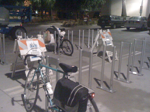
Stumbled upon this photostream while on LAStreetsblog.  It showcases the new bike corral installed at the Santa Monica Public Library, replacing two parking spots with 18 parking spaces for bikes.  Nice, simple action to encourage biking even more in already bike friendly Santa Monica. 

Monday, May 31, 2010

30 Seconds of Awesome


Kudos to Streetsblog Los Angeles for posting about "30 seconds of Awesome,"  a recent project by a UCLA Architecture graduate student that basically co-opted the 38 seconds of pedestrian only crossing time at Westwood and Le Conte Boulevards as an urban playground for willing college kids. 
Krisztina Jozsef, a second year graduate student in UCLA's architecture department designed what she termed "30 Seconds of Awesome."  Basically, during the thirty eight seconds of "pedestrian only" time in the intersection of Westwood and Le Conte, a couple of dozen students run out in the intersection and basically play in the street.  First a couple of warm-ups then tug-of-war, water balloons (with a clean-up time), jump rope, hula hoops, limbo and, most impressively, volley ball.  The students were in and out of the intersection before regular car traffic resumed, with Professor Mark Mack wearing what looked to be an orange prison jump suit yelling out the remaining time into a mega phone.
The project was built off the success of ideas such as Parking Day, Critical Mass, Ciclovia, and Flash Mob events that look to reprogram existing urban spaces as pedestrian zones, and create new recreational places to encourage healthy living.  Unfortunately, the project was just a one-time event, but it reminds me a lot of when I was a kid, and the street was used by people for block parties or wiffle ball and football games.  Cars still drove by, but the game would simply pause amid cries of "game off" until the coast was clear, and then resume with a chorus of "game on."  Great idea, and a reminder of ways we can reevaluate our existing neighborhoods. 

More videos, including Yoga and Tug of War, are available on LA StreetsBlog YouTube channel.

Saturday, April 10, 2010

Arid Lands Recap #2


(Image from Fritz Haeg.  All Rights Reserved.)
The Second Workshop in the Arid Lands Series was “Smart Landscapes: Yard, Driveway, Sidewalk, Street” and featured a talk by artist Fritz Haeg, architect Holly Harper, and landscape architect David Fletcher.  Fritz Haeg talked about his ongoing "Edible Estates" art project that has converted 8 lawns around the world into high-profile food producing gardens for the homeowners and residents.  Holly Harper discussed some of her work with the non-profit Northeast Trees which was founded by a landscape architect and installs urban green infrastructure in Los Angeles, including street trees and alternative stormwater infrastructure.  And David Fletcher discussed the different design strategies available for stormwater management, and presented some interesting case studies and conceptual work demonstrating how these tools can be applied to a site in a functional and aesthetic fashion.

By far some of the best quotables came from Fritz Haeg, in part because his project is designed to be provocative.  However, Holly's talk provided a nice technical case study of how you can build in stormwater capacity into an existing street with 95% impermeability, and David provided a nice conceptual framework for designers to think about how stormwater management can be part of an aesthetic language that has cultural meaning and beauty beyond the purely technical innovation these new strategies represent.  Below are some of the interesting tidbits (recorded and or paraphrased to my best ability) that came out of the talk:

“Lawn is the biggest crop in the United States (if you include our front yards in the equation)” - Fritz Haeg

"I like to create landscapes that demand participation. You can't learn to grow food from the internet, you have to interact with people." - Fritz Haeg

"People make decisions (about our built environment) that we are left with." - Fritz Haeg


"Multifunctional design is like the difference between a regular knife that can cut things and a Swiss Army Knife that can still cut like a knife, but it also has all of these other capabilities." - David Fletcher

Friday, March 26, 2010

Cap Freeway Ideas Abound

 (image from The Architect's Newspaper.  All Rights Reserved.)
Freeways everywhere and not a cap in sight.  Well, maybe not much longer in Los Angeles.  The Architect's Newspaper provided a great profile of the 4 freeway cap projects under consideration that have the potential to drastically improve the urban character, and re-introduce some much needed open space in LA . Two of them are in downtown, one is in Hollywood, and most recently a new study in Santa Monica has begun near the new proposed civic park awarded to James Corner's Field Operations.  AECOM is handling the all of the conceptual efforts in LA, but the article also points to Don Scott as one of the influential forces behind LA's flourishing efforts to caps some of its ubiquitous freeways.

The cap park frenzy here can largely be credited to Don Scott, an investment banker and former chairman of the Hollywood Central Park coalition, also former chairman of the Hollywood Chamber of Commerce. Scott said that his inspiration for the Hollywood Central Park cap came from an article he read about Boston’s Big Dig. “I remember driving over the Hollywood freeway and thinking about the connection between the two environments.”

After some research, Scott discovered other freeway cap parks in various phases in Cincinnati, Seattle, Phoenix, the District of Columbia, Boston, Hartford, CT, and Charlotte, NC. In LA, a small freeway cap park was built over the 210 Freeway in La Canada-Flintridge; another is under review in Ventura County. The rest of the chamber was quick to support Scott’s idea, and it took off.

Despite the immense cost of decking over freeways, such projects are seen not only as boons to urban planning but also economic development. The lots in pink are potential development sites, which could even help pay for construction.
Although the projects are a long way away from realization, the opportunities to create new, green cores  throughout LA is seductive, especially given the dearth of public space available. Hopefully, funding can be arranged in the near future to push the projects towards reality.

Saturday, March 20, 2010

Arid Lands Institute - Spring 2010 Design Workshops

The Arid Lands Institute at Woodbury University in Burbank has announced their Spring 2010Workshop series.  Focusing on "Smart Design Strategies for Managing Water + Energy in a Changing Climate," it should be an excellent series featuring a nice mix of design professionals, sustainability experts, and advocates.  The free workshops are designed to introduce laypeople, developers, stakeholders, and design professionals alike to water- and energy-conserving design strategies. While I imagine some of the content may be general for knowledgeable participants, it promises to provide regional case studies, and an opportunity to dialogue about sustainable design strategies for Los Angeles.  Registration information is available on their webpage.

Workshop_1: Smart Buildings: Green Roofs/Green Walls
Saturday, March 27th
9 am – 3 pm
Linda Taalman, Taalman Koch Architecture
Deborah Richmond, AIA, Touraine Richmond Architects
Stephanie V. Landregan, ASLA, UCLA Extension Landscape Architecture


Workshop_2: Smart Landscapes: Yard, Driveway, Sidewalk, Street
Saturday, April 3rd
9 am - 3 pm
Fritz Haeg, Edible Estates
Holly Harper, NorthEast Trees
David Fletcher, Fletcher Studio


Workshop_3: Smart Systems: Rainwater Harvesting + Greywater
Saturday, April 17th
9 am - 3 pm
Leigh Jerrard, California Greywater Corps
Jenna Didier, Fountainhead Design

Tuesday, February 23, 2010

Santa Monica Palisades Garden Walk Update

(image from The Architect's Newspaper.  All Rights Reserved)
James Corner and Field Operations have won the competition for Santa Monica's future 7-acre Palisades Garden Walk.  Best known for their work on the recently completed High Line project in New York, Field Operations was selected for their landscape expertise and strong work in the public process.  Interestingly, teams did not present any concept designs in their interviews, so the design for the Garden Walk should be a work produced with the citizens of Santa Monica.  As for reaction to the selection, Christopher Hawthorne, the architecture critic for the LA Times, had a promising look at the potential for Corner and the project.  Let's hope some of it can be realized over the coming years.

Sunday, February 14, 2010

Life Without the Lawn? - Right of Ways

So what exactly does life in Southern California look like without the lawn?  Given that lawn is the ubiquitous ground cover here, what other visual prototypes exist for our front yards and interstitial spaces?  Below are some visual examples of that most interstitial of spaces, the public right of way on residential streets.  Usually covered in lawn with some street trees (we hope), the right of way exists as a public owned entity with no real public use.  So, assuming sustainability concerns pushes the lawn out of Southern California, what other aesthetic options exist?  A quick stroll through my neighborhood produced these non-traditional right of ways.  While not all of these may be great solutions aesthetically or sustainably, it was interesting to think about what the right of way could be beyond a green carpet. 

Saturday, February 13, 2010

The Fifth Ecology - Los Angeles Beyond Desire


The Fifth Ecology - Los Angeles Beyond Desire project is, in their own words:
An urban planning proposal for the Los Angeles River area in downtown Los Angeles. Developed by the post graduate course "Resources 08: Los Angeles Beyond Desire" at The Royal Collage of Fine Arts, Stockholm Sweden.
Sadly, I missed the actual display of this project downtown last November / December, but there is still a digital version of it online.  The project write-up is an intriguing read that provides a number of highly conceptual, but interesting systemized approaches for rethinking the structure and operation of Los Angeles.  Like many other urban transformation visions, it uses the LA river as the key transformation space for a reclaimed LA.  After perusing it briefly, some of the interesting ideas that stood out to me:
* Dog Tongue Town, which uses biomimicry to define new urban form and block pattern based around water channels mimicing water distribution on a leaf.
* Pocket Public Space, which advocates for returning small chunks of land into public space to infuse LA's density with more open space.  (FYI - some of this is already beginning with creative public / private partnerships in West Hollywood among others)
* Agrimids, or dense, multi-dimensional housing units that produce their own crops through a mix of private gardens, community gardens, and large-scale agricultural terraces incorporated into new building prototypes.
 Below are some images from the project, highlighting the Dog Tongue Town and Agrimid.  

Tuesday, January 26, 2010

Clip-on Architecture


(image from Urban Omnibus)
Nice summary article presented on Urban Omnibus called Clip-on Architecture: Reforesting Cities.  It presents a succinct overview of the different systems that exist for greening and revegetating our existing built environment to make them more sustainable.  Overall, none of the strategies are particularly new to most design professionals, but representing them in a public friendly way is always appreciated, and the final graphic (see above) showcasing how the systems could work together in a more holistic fashion is an inspirational gem.  Here the strategies transform from simply 'clip-on' architecture to function more successfully as a comprehensive landscape solution.  Because, ultimately, green efforts matter only in regard to their scale of influence. Site-scale solutions solve site-scale problems while holding a potential to affect larger-scale concerns.  It is by coordinating these smaller interventions that these potential impacts are actualized to realize larger-scale change.  Together multiple site-scale solutions begin to produce a community change that can potentially affect a region and beyond.  Hopefully cities like LA can partner an interest in 'clip-on' solutions with an effective landscape-scale understanding to truly reforest our built environment in a profound way. 

Sunday, January 24, 2010


(image from LA Times.  All Rights Reserved.)
The LA Times has a great story and accompanying interactive photo gallery comparing parts of downtown from 1951 to today.  Both sets of photographs were taken from the observation deck at City Hall, and provide an interesting glimpse into how much turnover can happen in 50-plus years, as well as a glimpse into the layered history of downtown. 
When the first set was shot in January 1951, City Hall was California's tallest building, a literal and figurative symbol of the power of the metropolis' downtown. By law, no building could be built to overshadow the structure.

What surrounded it was a city in transition: The Hollywood Freeway had opened in December 1950, cutting through a swath of the area, and many beaux-arts and Victorian structures had already been razed for parking lots.

Both of those developments portended the coming domination of the car -- and the corresponding boom of suburbia that would mark downtown's rapid decline.

. . . .

But take the elevator to the top of City Hall today, and there are signs of new development in downtown as well.

There are the sharp angles of the new Los Angeles Police Department headquarters, which opened just across the street in 2009; a new train line that stretches to the Eastside. And the downtown skyline keeps growing, this time to the south with a cluster of new condo and hotel towers rising near Staples Center.

From the top of City Hall, it's hard to tell that 40,000 people now live downtown, a dramatic demographic shift that is more easily detected on the streets of the city center.

Saturday, January 23, 2010

ASLA's New Sustainable Landscapes Online Showcase?

The American Society of Landscape Architects (ASLA) has launched a new Sustainable Landscapes Online Showcase to highlight great examples of sustainable landscape design and the benefits they provide to the environment and our quality of life.  The initial offering includes 10 case-studies spanning a range of project types and regions.  Each case study includes project images, key benefits, a downloadable project fact sheet, and relevant links to learn more about the project. 

All told, the new initiative is a great start to publicizing sustainable landscape design for the public and professionals alike, but LA and western residents will find themselves appropriately disappointed in the lack of broad regional representation in the initial case studies (residents of the Midwest and South will find themselves equally underrepresented).  Of the ten initial projects, four come from the Pacific NW (two in Seattle, WA and two in Portland, OR),  and two come from the Northeast (one from NYC and one from Wellesley, MA).  In contrast, the West has only one project listed, a small residential project in SF, and the Southwest has no projects presented.  In other words, none of the case studies provide a true example of semi-arid or arid landscape design. 

Is it that no one is doing any sustainable design in the West, or that no great projects exist of semi-arid or arid design?  Hardly - in fact, recent project winners highlight the great sustainable design work going on in California, Arizona, and Texas.  Perhaps it is an example of regional bias, or a lack of proper exposure to the work going on outside of the Pacific NW or East Coast (some might argue the same problem of regional coverage in Landscape Architecture Magazine), but as someone that has lived and worked in California, Arizona, and Chicago, it is distressing to see none of the great worked from these regions represented on par with the Pacific NW or East.  If sustainability is truly a metric based largely on compatibility with one's surrounding ecological context, then we need to promote projects that respond to the many diverse ecological contexts that make up the US.

While Portland and Seattle certainly deserve a lot of credit for their innovative approach to environmental design, it is a disservice to the number of dedicated professionals throughout the country that none of their hard work is properly represented.  Hopefully with future iterations, the ASLA will showcase this work as well.

Wednesday, January 20, 2010

LA makes list of 50 Top Low-Car Cities

Human Transit had an interesting group of observations today about how we move towards a low-car city based on a listing of the Top 50 Low-Car Cities in the US (defined by populations of over 100,000) pulled from Wikipedia and the Carfree Census Database.  Not surprisingly, the New York Metro area dominated the top three spots, and was followed primarily by east coast cities in the top 10.  California did make the list though, with San Francisco taking the 14th spot, and East LA sitting at #32 and LA at #49 overall. 
1. New York City, New York 55.7%
2. Newark, New Jersey 44.17%
3. Jersey City, New Jersey 40.67%
4. Washington, D.C. 36.93%
5. Hartford, Connecticut 36.14%
6. Baltimore, Maryland 35.89%
7. Philadelphia, Pennsylvania 35.74%
8. Boston, Massachusetts 34.91%
9. Buffalo, New York 31.42%
10. New Haven, Connecticut 29.74%
. . .
14. San Francisco, California 28.56%
32. East Los Angeles, California 21.24%
36. Oakland, California 19.62%
45. Berkeley, California 17.01%
49. Los Angeles, California 16.53%
And, as Human Transit notes, the list deals with "incorporated cities, which are things of very unequal size and shape bearing little relation to the organic form of urban regions.  For example, Los Angeles at #49 would score much higher if the vast low-density San Fernando Valley were not part of the incorporated city, and high-density innermost suburbs like East Los Angeles (#39) were included instead."  In other words, on the bright side of things, car happy LA is actually more of a low-car city than expected.

The article posits three key factors behind low-car ownership: age, poverty, and dominant universities.  As such, older cities score well because they were built well before the car was commonplace, producing a functional urban infrastructure for residents without a car.  Poverty obviously mitigates the economic ability of residents to own cars, and a dominant university population increases density without a need or ability to own cars.

Interestingly, green guru city of the West, Portland did not even make the top 50th low-car cities, prompting another fascinating question from the article:
How long will it take for a city that lacks age, poverty, or dominant universities to achieve the kind of low car ownership that these 50 demonstrate?  How soon, for example, will a city be able to create a combination of density, design, and mixture of uses that yields the same performance as an old city that naturally has those features?

Portland is probably the most promising such city in the US, and it's not on the list.  Only 14% of households there don't have a car, so it's probably well down in the second 50.  Like many cities, Portland has been doing everything it can to build a dense mixed-use urban environment.  It's the sort of city that convinces the Safeway supermarket chain to rebuild their store with townhouses and residential towers on top.  But while people are moving into the inner city, they don't seem to be selling their cars when they do, nor do they seem to be going to work by transit. 

While Portland is successfully moving towards a dense urban condition, is appears people may not be willing to give up their cars yet.   So, is there much hope for traffic clogged LA?  No doubt we need to reduce the number of automobiles, and even more importantly, automobile trips in Los Angeles to improve environmental quality and alleviate traffic.  Hopefully downtown's resurgence and improved urban design and transit initiatives throughout the city will keep moving us toward this lofty goal.  While much remains to be done, at least our place on the list provides some hope that a less car-centered LA may be in our a future.

Tuesday, January 19, 2010

Santa Monica Palisades Garden Walk Finalists Announced


View of Project Site and Context.  Project will take place in large dirt area east of the Santa Monica Pier. 
(image from http://archpaper.com/uploads/image/RFQ_PalisadesGarden.jpg)

I am a bit late on this announcement, but the City of Santa Monica has selected 6 finalists for the high-profile Palisades Garden Walk and Town Square project.   The impressive group includes: Peter Walker and Partners, Gehry Partners, James Corner Field Operations, Studio Works, Gustafson Guthrie Nichol, and SWA Group.

The project will redevelop a large patch of dirt between the Santa Monica Pier and the Santa Monica City Hall (see detailed view of project site to the right - image courtesy of City of Santa Monica).  The project will include 7 acres of park space bordered by future residential development with the goal of creating a dynamic open space that will connect the Santa Monica Civic Center to the rest of the city. The project scope is summed up well by Architect's Newspaper, which first reported the finalists in December:
According to the project’s RFQ, the Town Square, adjacent to Santa Monica’s City Hall, is set to be a space for cultural and civic events, while the Palisades Garden Walk, to its south, will focus on the city’s unique “cultural” and “horticultural” offerings, including a botanical element and water features. Adjacent streetscape improvements, as well as pedestrian and bicycle paths, will connect the parks to the city, while Moore Ruble Yudell’s Santa Monica Village will sit just adjacent. The city has committed $25 million for design and construction of the project, and construction is planned to begin in August 2011.
Funding for the project was approved in June, and interviews will occur this month with a winner chosen sometime shortly thereafter.   The selection panel is said to include Ken Smith and USC architecture dean Qingyun Ma.  A public process will be implemented by the winning team to help develop the final plan.

More coverage of the project can be found at the following websites:
The Dirt
Curbed LA
Santa Monica City Government - RFQ and Base Images

Friday, January 15, 2010

A + D Museum: Spring Urban Hike Schedule Announced


(image from http://aplusd.org/v5/. All rights reserved by A+D Museum Los Angeles)
Don't know much about Los Angeles, or ever wondered more about the urban environment in which you live?  The Los Angeles Architecture + Design Museum have teamed up with Mike Sonksen (aka Mike the PoeT) to showcase the hidden jewels of LA.  Each "hike" explores a diverse and interesting community of Los Angeles, offering cultural, historical, and architectural backgrounds to the neighborhoods along with a  unique poetry performance by Mike. Their Spring Urban Hike schedule includes:
1/31 -   Downtown's Historic Core
2/7 -    Koreatown
2/27 - Boyle Heights (Including a Goldline Ride)
All tours start at 11AM, and are free for A+D members.  General admission tickets are $15, or $5 dollars for students per tour.  A three-tour package is also available for  $30. RSVP at info@aplusd.org or 323.932.9393.